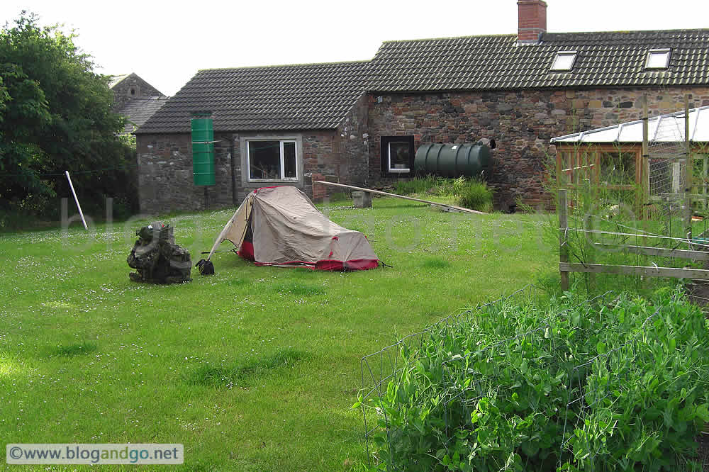
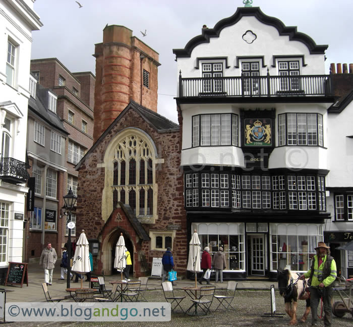
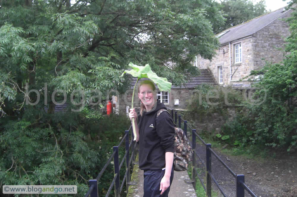
Completing Hadrian's Wall walk (6 of 6)
Hadrian's Wall Walk - Heddon to Segdunum
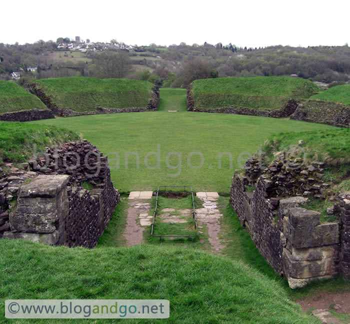
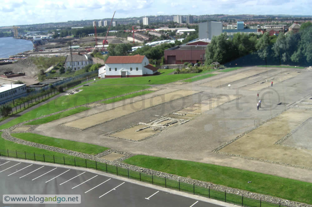
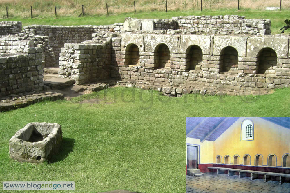
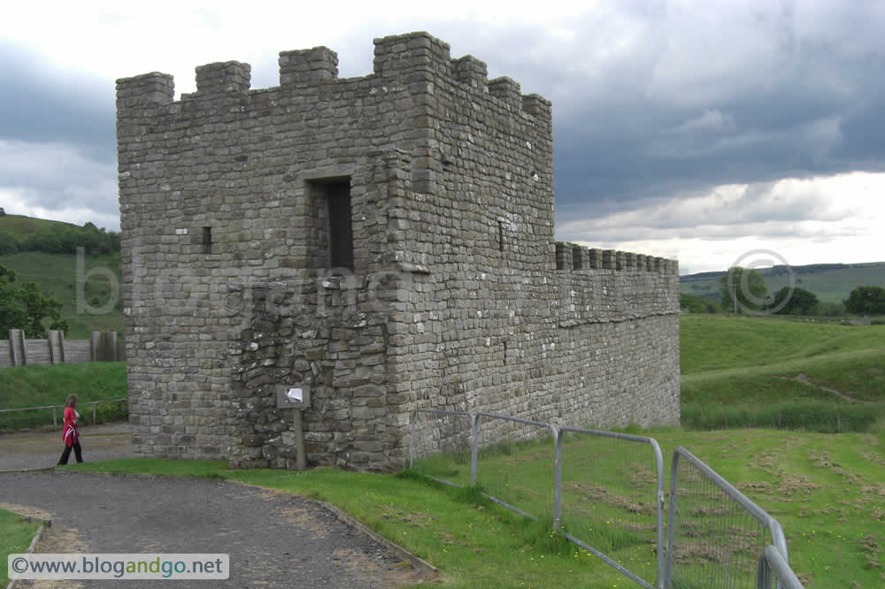
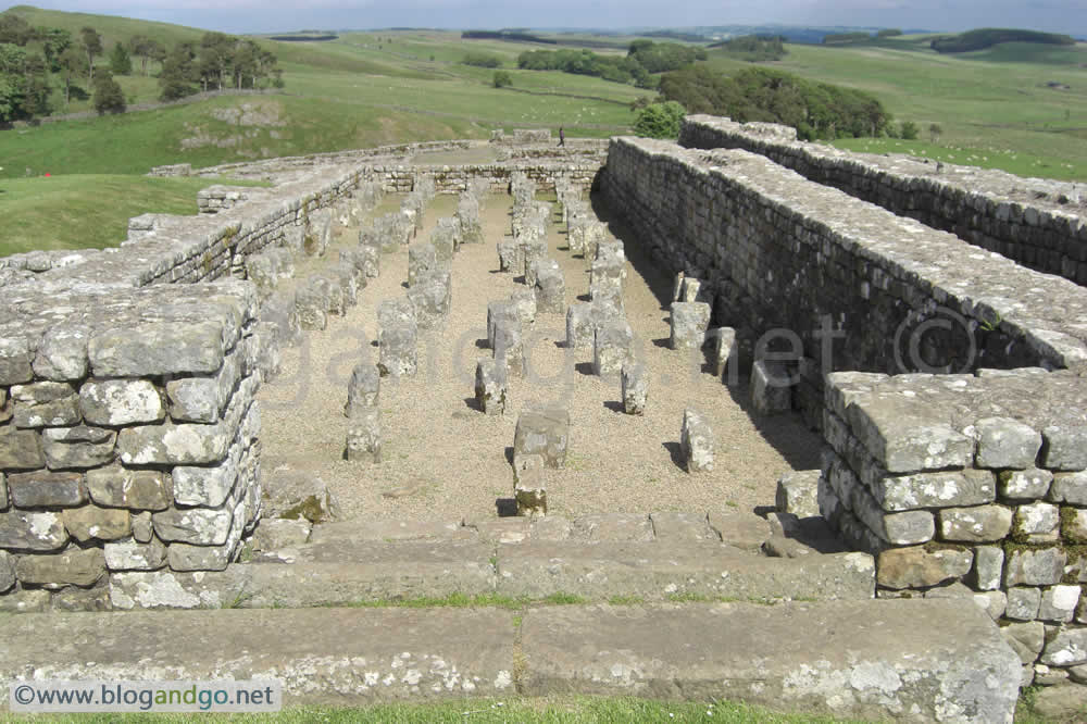
The end of the walk was 15 miles away and from looking at a map it also promised to be a very different one. For most of the first mile out of Heddon the scenery was pretty much like the previous day; country views but with the added pleasure of a stroll along the rural end of the River Tyne. After this the scenery gives way to being in the outskirts of Newcastle until you find yourself walking along the River Tyne into the heart of Newcastle, and the end of the Hadrian's Wall walk at Wallsend. The end point is the site of the Roman fort of Segdunum, and the excavation forms part of an impressive museum and includes a full size reconstruction of a bath house.
Day 6 - Chesters to Segdunum (15.5 miles)
The day darkened as we left the sunny rural environment of Heddon-on-the-Wall behind and entered the smog and poverty of the archetypal north east, with accents too thick to understand and hordes of teenage mums decked out in the latest shiny sports wear. Not to mention the graffiti, dog excrement and burned patches of land, presumably the sites of torched stolen cars. For the visitor, be assured that this open safari will eventually pass as the path snakes into the centre of Newcastle, only to be walked through during the daylight hours, and past landmarks such as the Millennium Bridge.
After a look around the visitor centre it was time to marvel at the achievement of walking such a distance, seeing so much beauty, barring the last 15 miles, and jump onto the bus with armed escort all the way back to Greenhead and a drive home.*
* Newcastle is not actually quite like how I've portrayed it. Shiny sports wear is not as fashionable anymore.
 wall reconstruction.jpg?open)
Completing Hadrian's Wall walk (5 of 6)
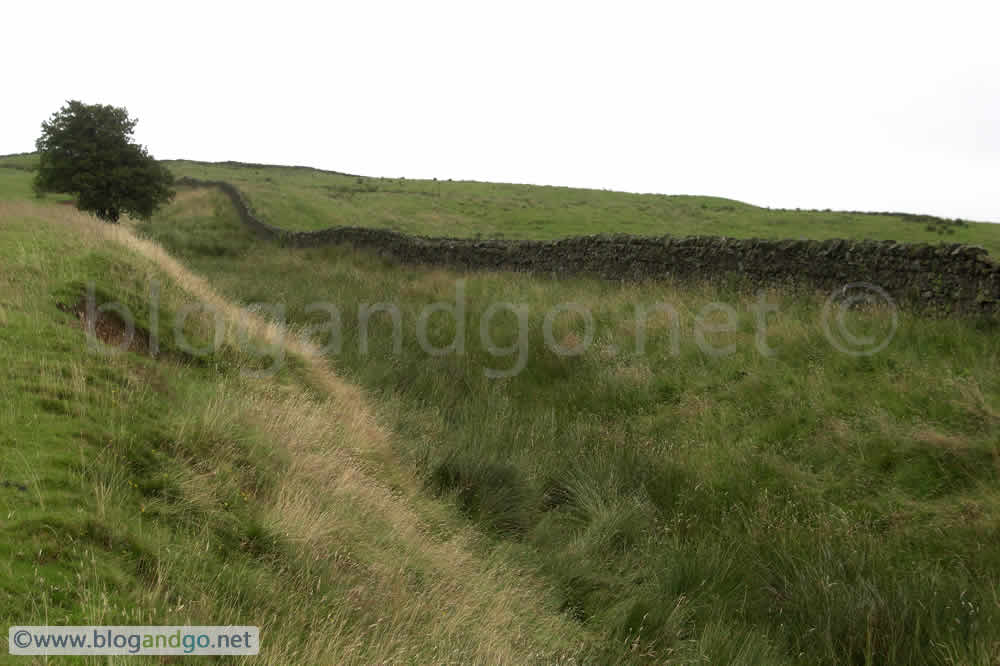
Hadrian's Wall Walk - Chesters to Heddon
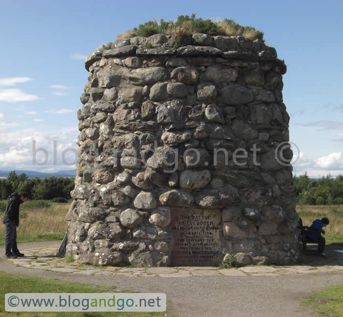
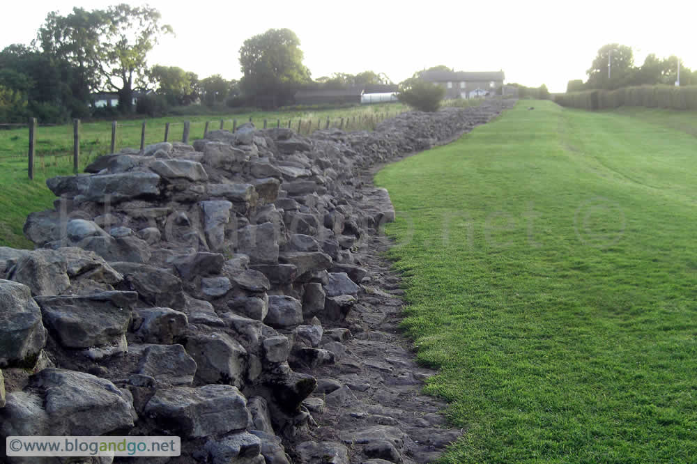
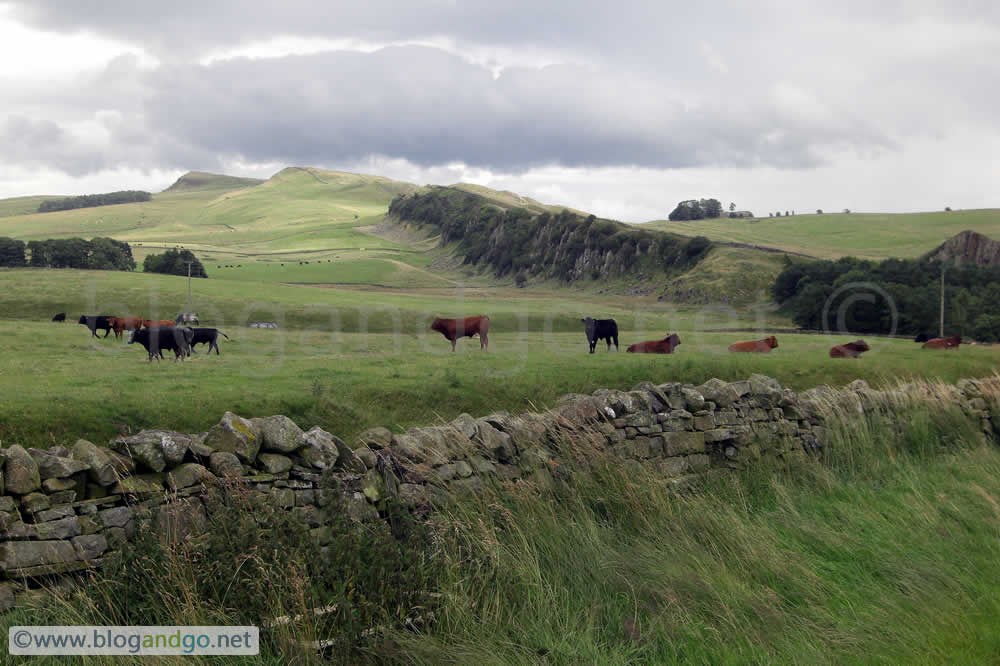
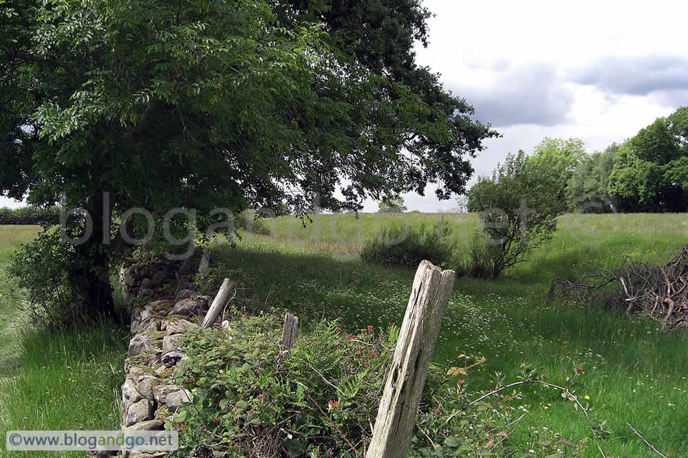
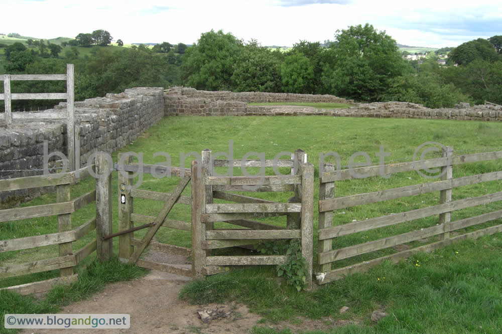
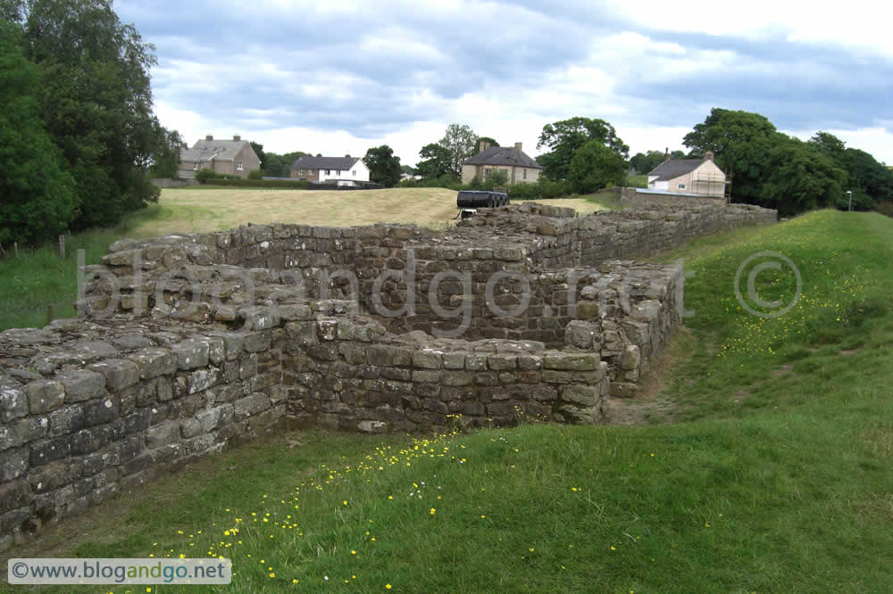
The walk from Chesters to Heddon-on-the-Wall is flat, across low lying farmland, and for the most part parallel to the B6318, otherwise known locally as the Military Road, though not to be confused with the Roman Military Way that was built immediately to the south of the Wall. The Military Road was built in response to the poor road conditions encountered by British forces under Field Marshal Wade in 1746 when fighting the Jacobite rebels supporting the insurgent Bonnie Prince Charlie. Its most westerly point is Greenhead, and the road is responsible for much of the ruin that can be seen, or not seen today. Long stretches of the road are built on the foundations of the Wall, but luckily the topography of the crags saved what Wall we can see today as the road diverted to the south of these.
Day 5 - Chesters to Heddon (15.5 miles)
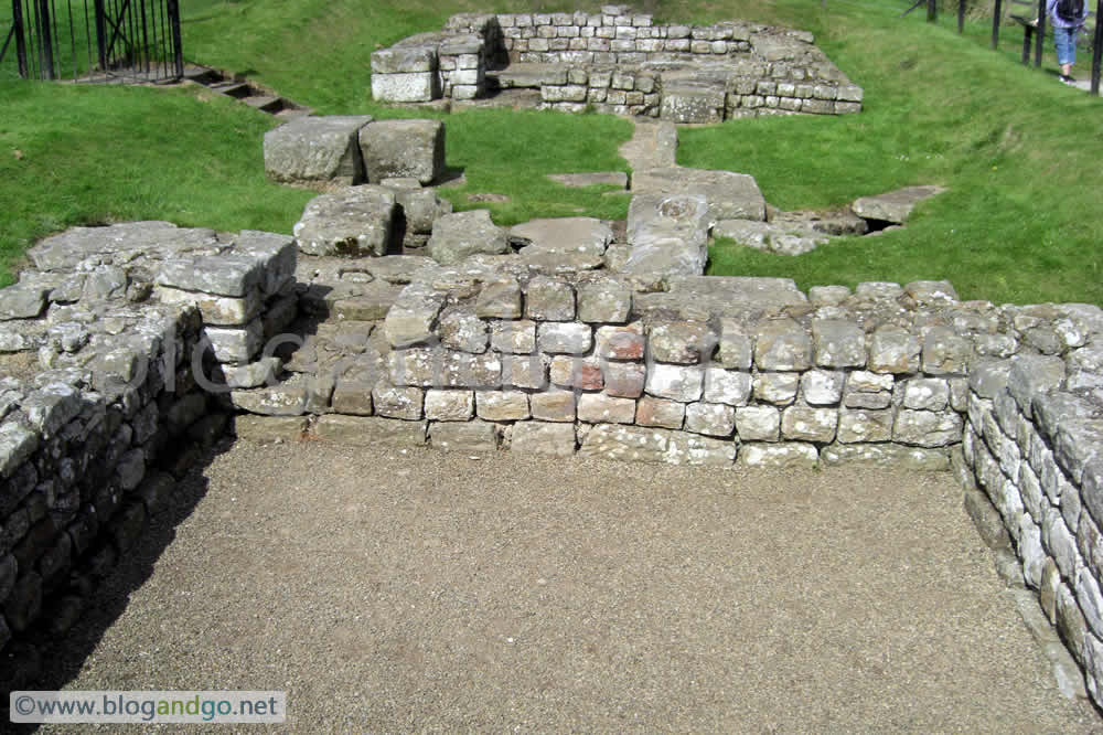
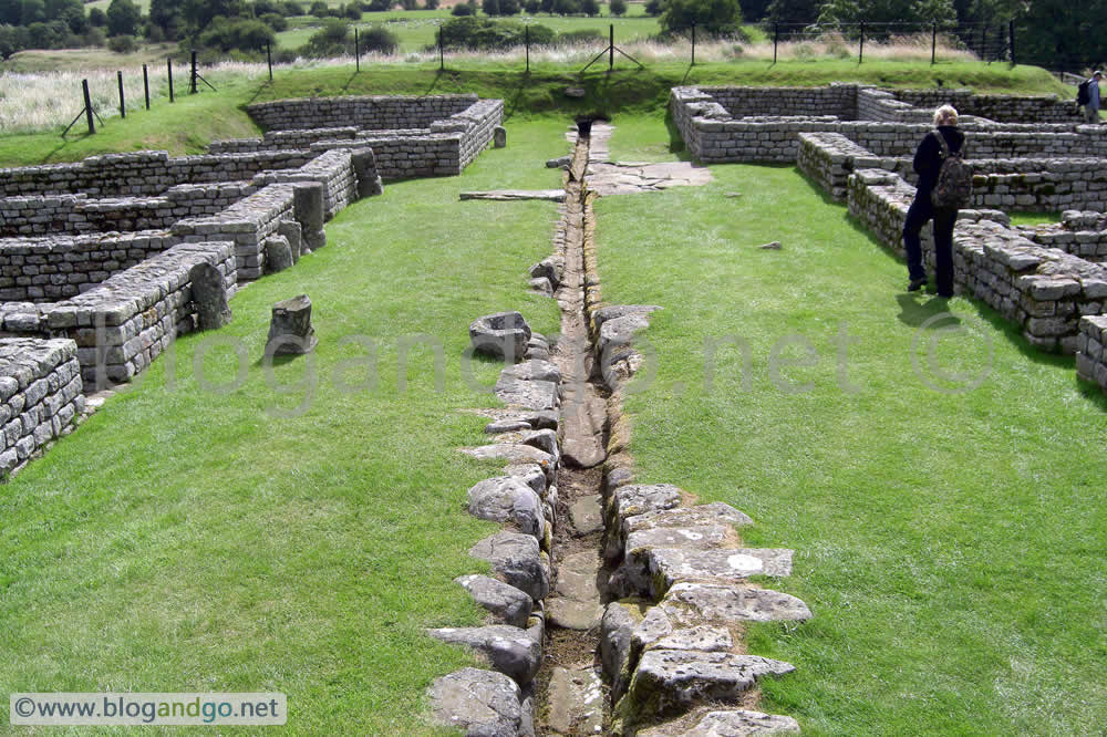
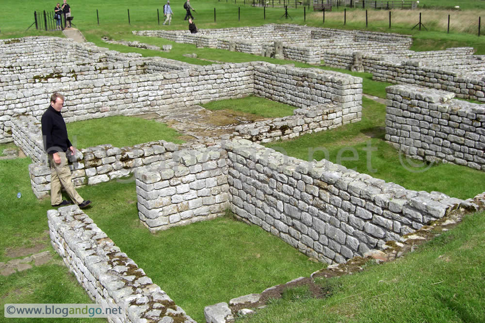
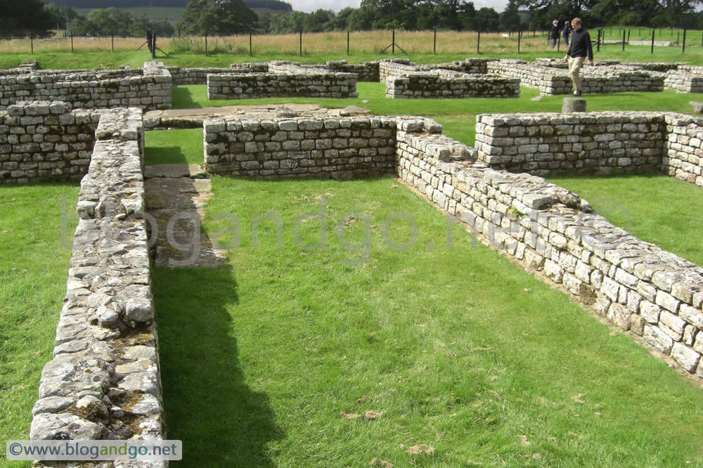
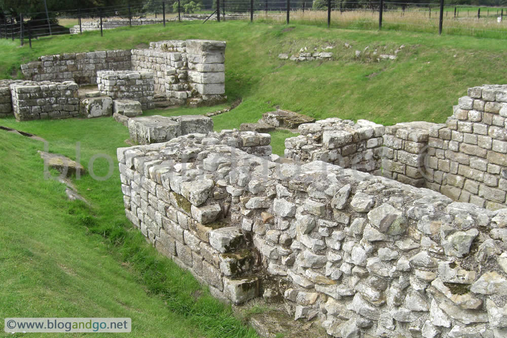
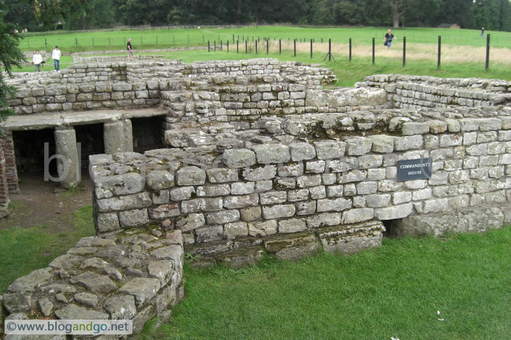
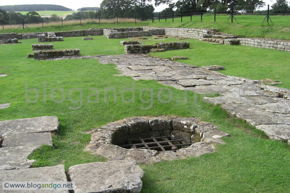
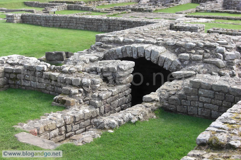
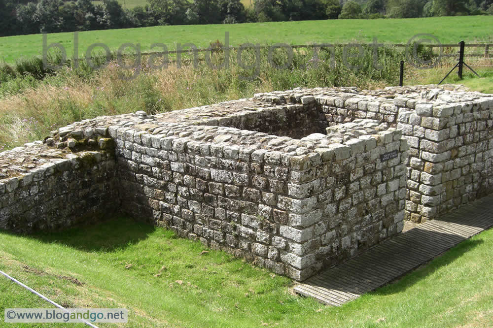
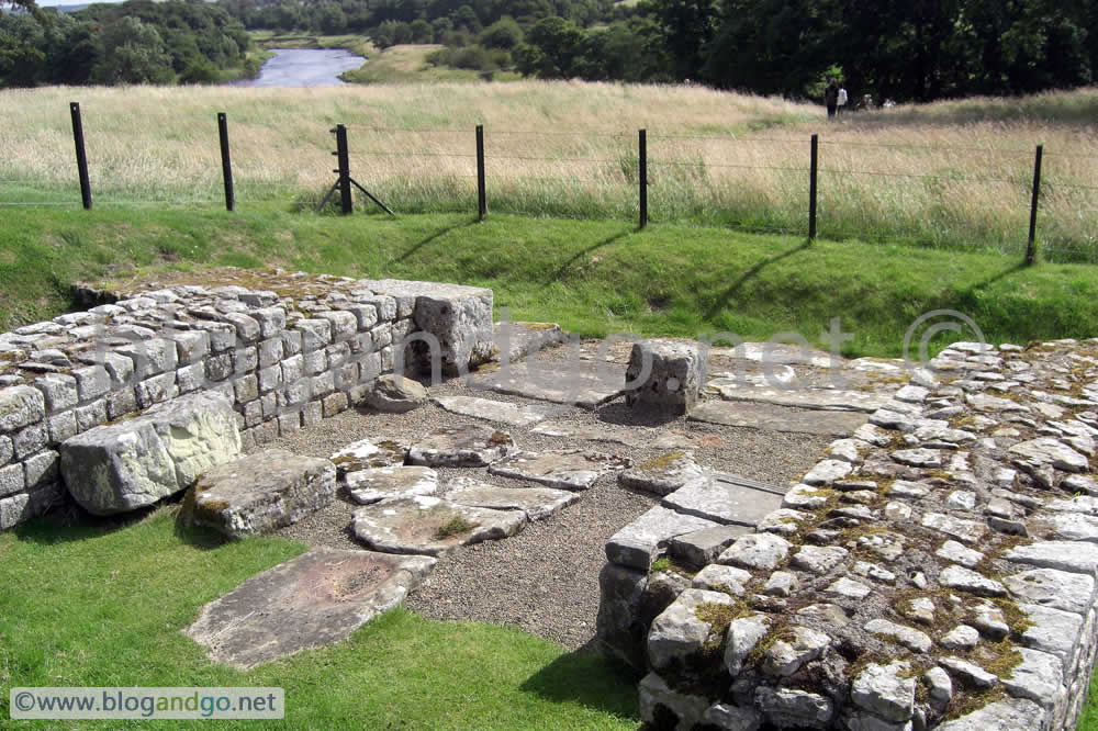
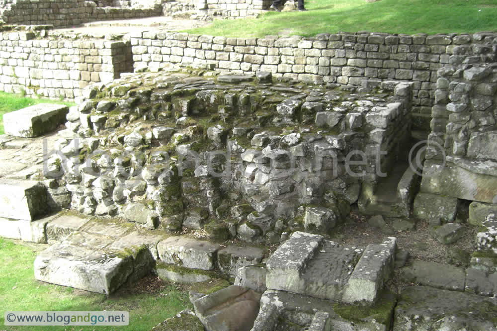
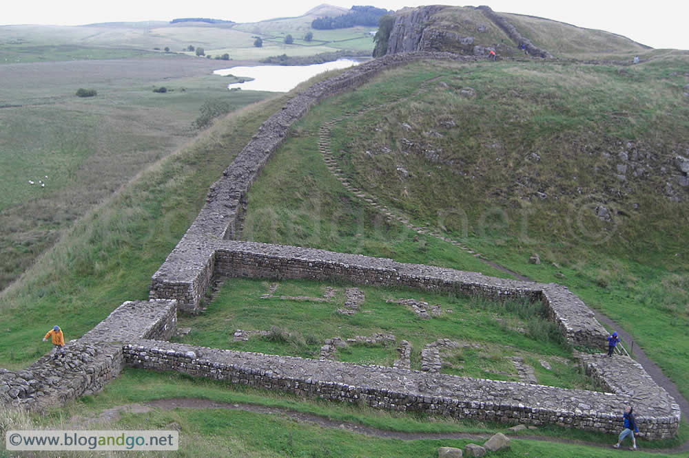
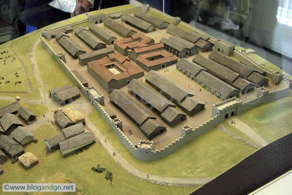
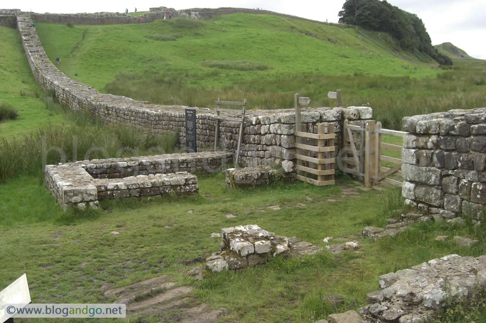
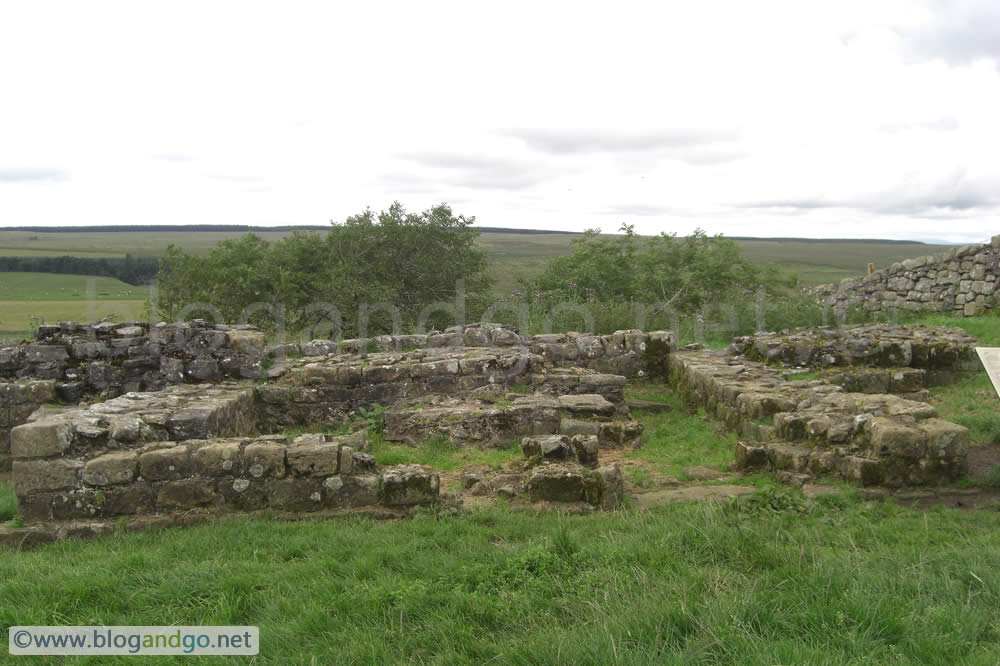
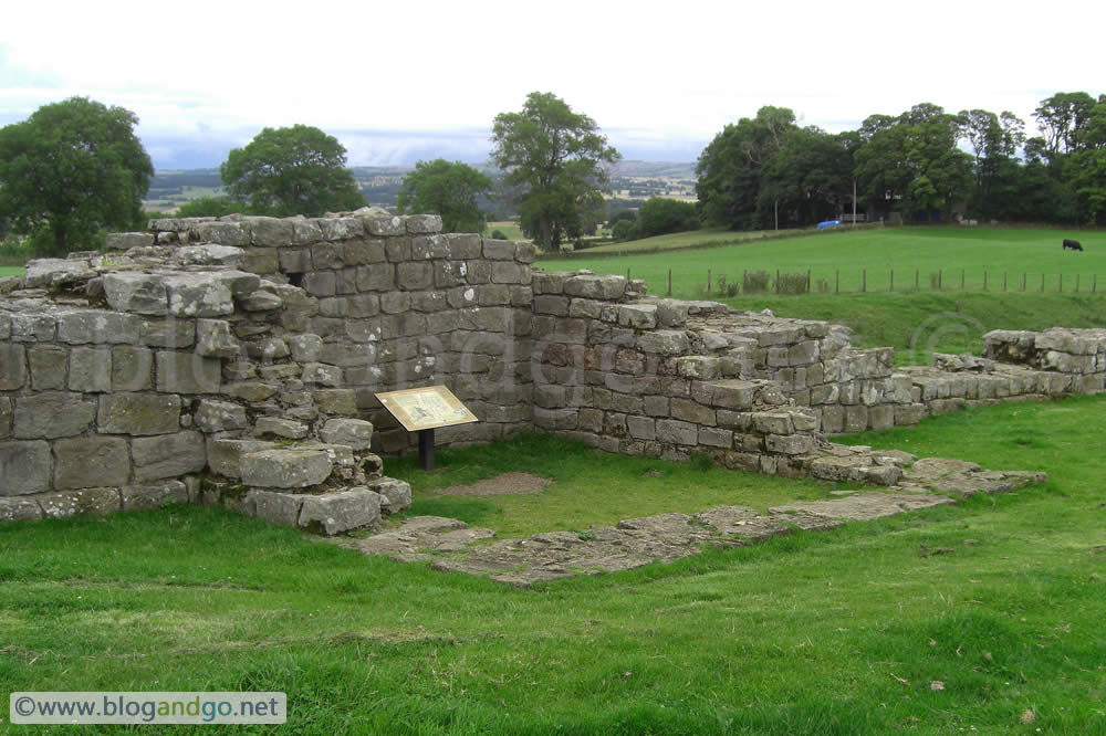
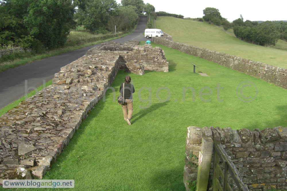
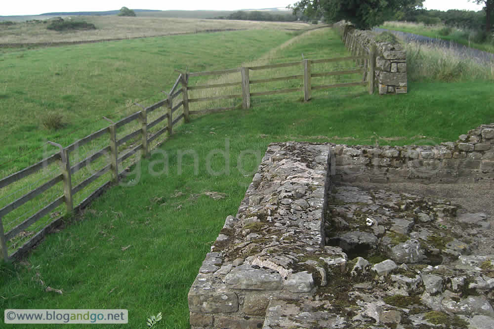
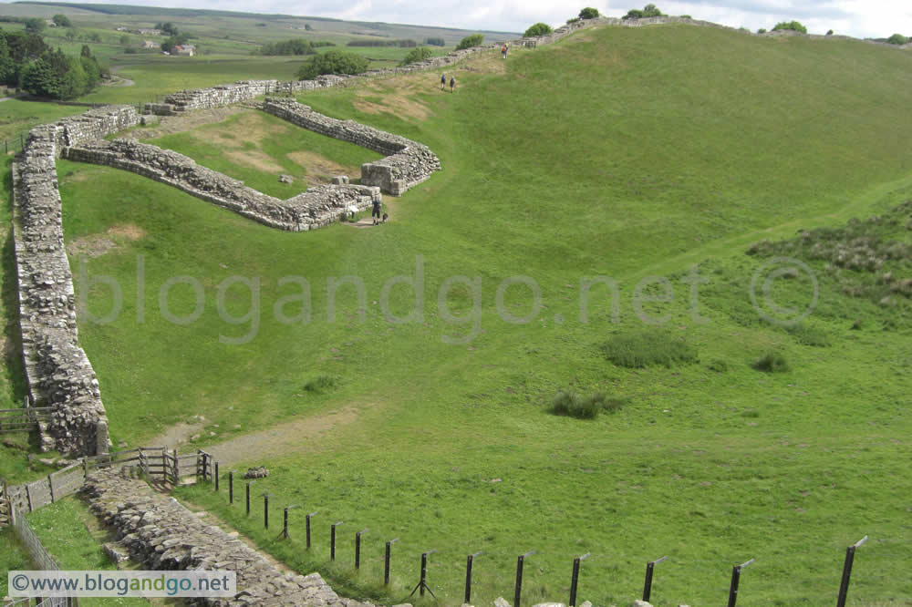
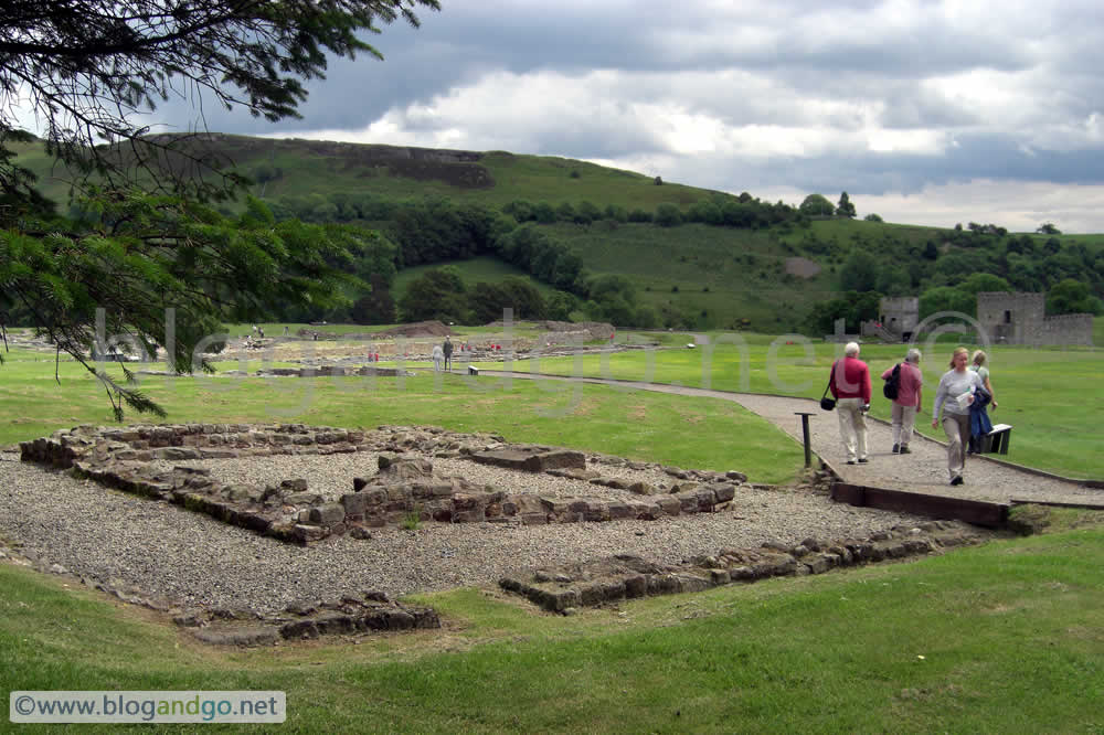
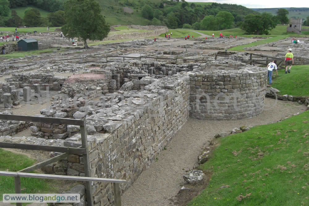
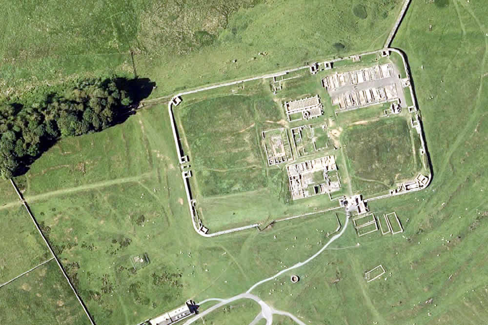
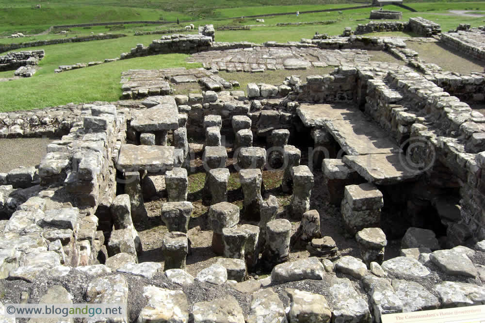
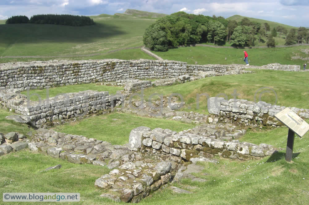
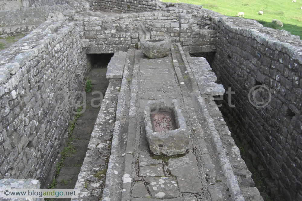
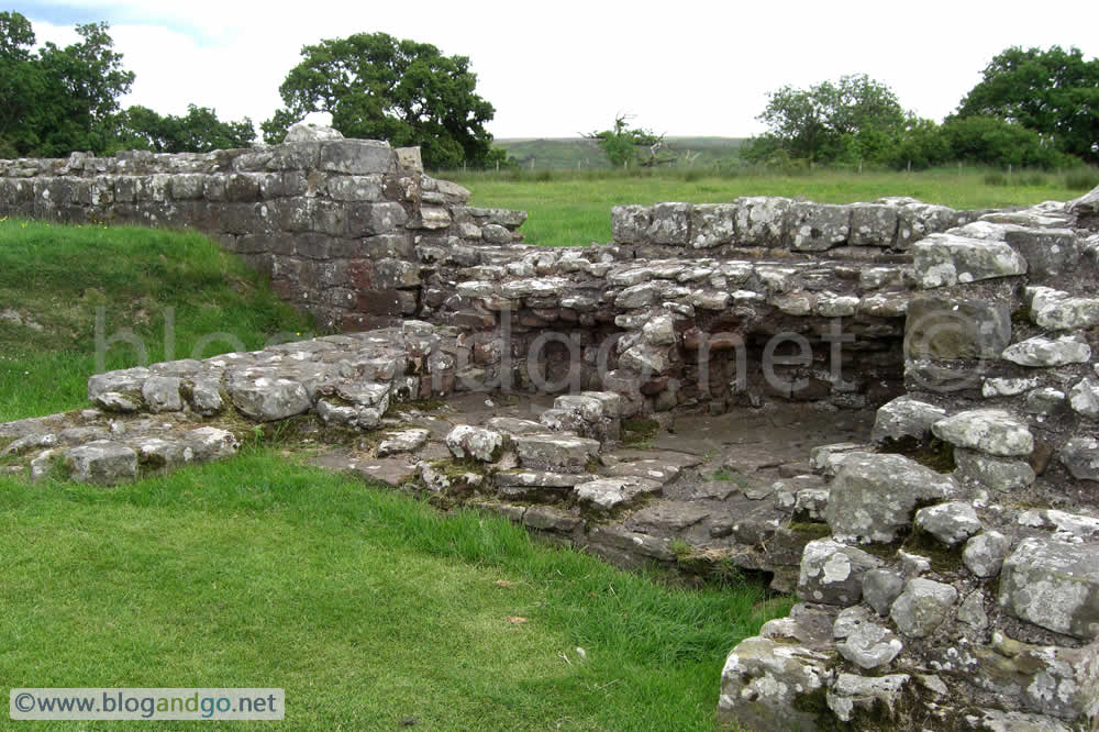
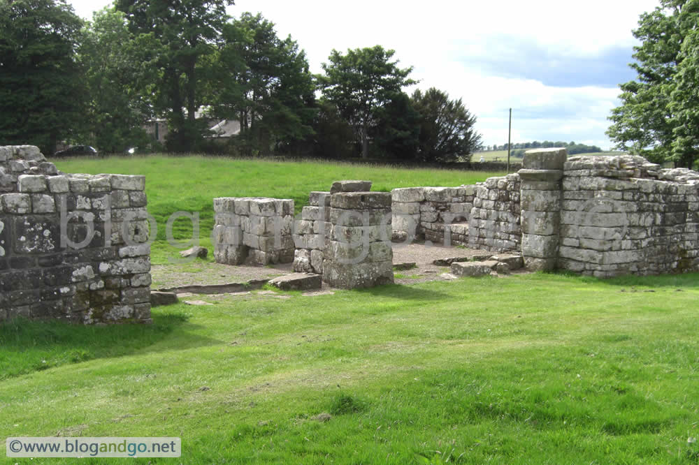
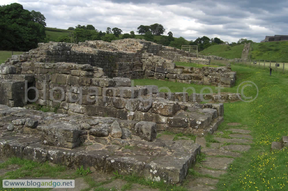
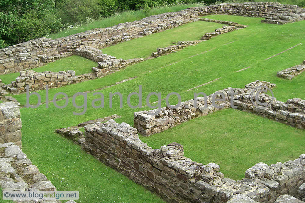
The end of yesterday's journey was Chesters Fort meaning that today started with a wander around its ruins. Chesters Fort lies in a valley and was placed astride the wall with all but one of its four gates opening north of the wall. The circuit of the defences was reinforced with a number of towers and at the four corners. Outside the bath house and south of the wall was the bath house, one of the best preserved Roman buildings in Britain. This and the accompanying small museum is a good day trip in itself, but it was just the start of foot wearying trek to Heddon-on-the-Wall, over 15 miles away to the west.
.jpg?open)
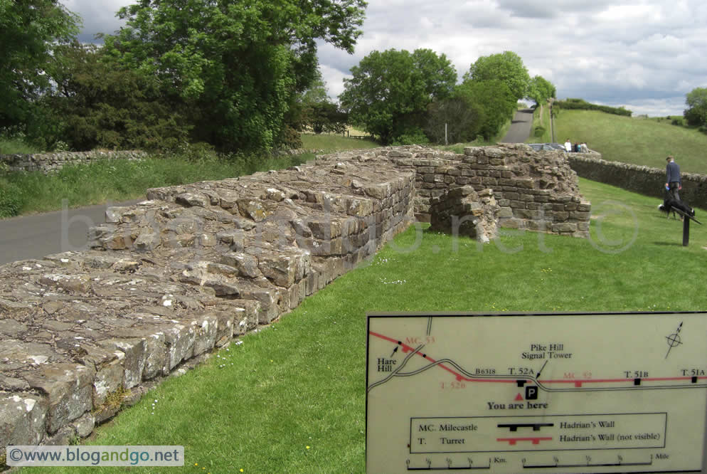
 Turret 26b.jpg?open)
.jpg?open)
Completing Hadrian's Wall walk (4 of 6)
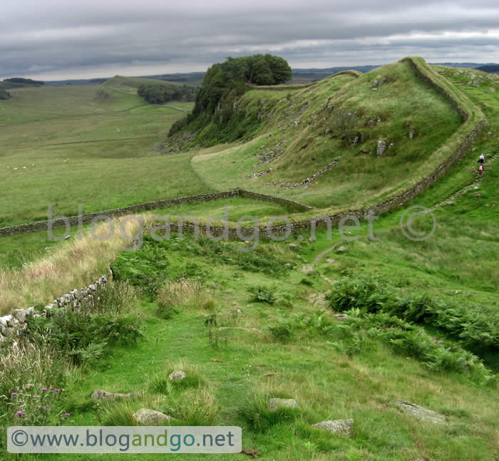
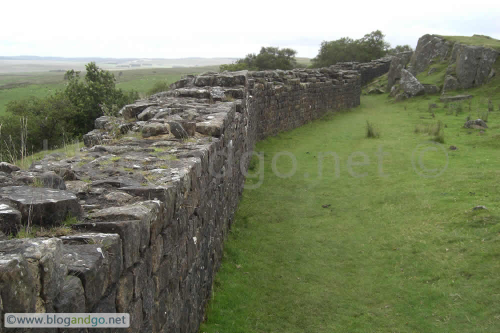
Hadrian's Wall Walk - Steel Rigg to Chesters
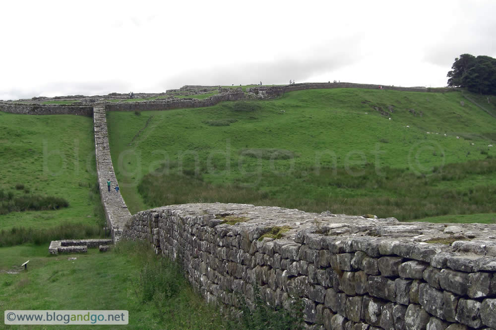
This section of path is also some of the most scenic. If starting from close to the Steel Rigg car park you will be faced with a number of climbs and descents as you follow before the path gradually gives way to lower lying farmland and the occasional tree plantation. It will converge with the road (General Wade's Military Way) and follows this almost all the way to Chesters. Coming to the end of the highland section also marks a psychological as well as physical change in scenery and terrain. From this point on it's almost a case of continuing no matter what and ignoring the sore feet; the hard part is now over. Unless you are coming from Newcastle in which case the stroll is coming to an end and the pain is about to start.
Day 4 - Steel Rigg to Chesters (12 miles)
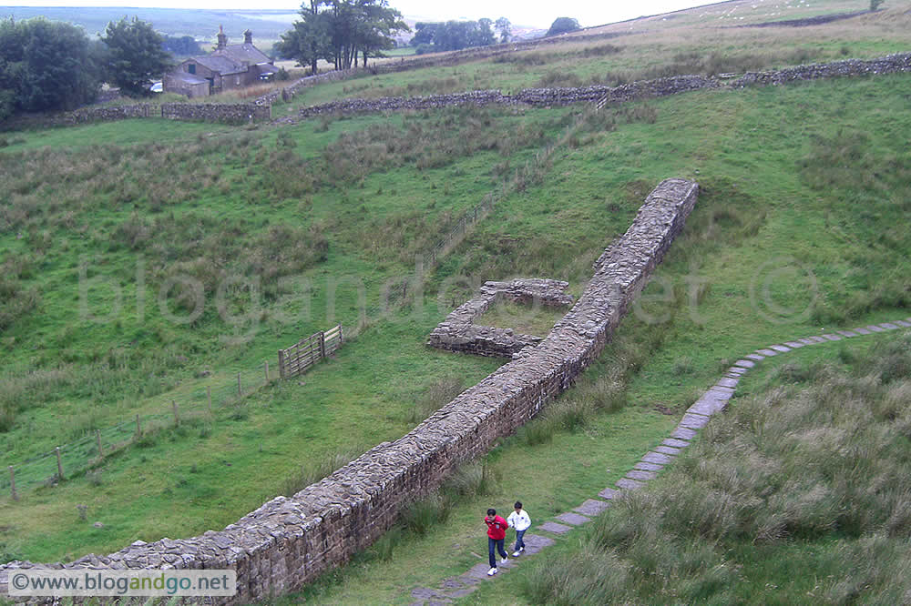
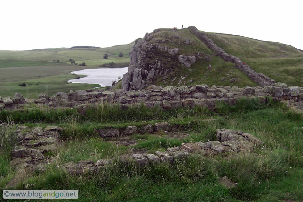
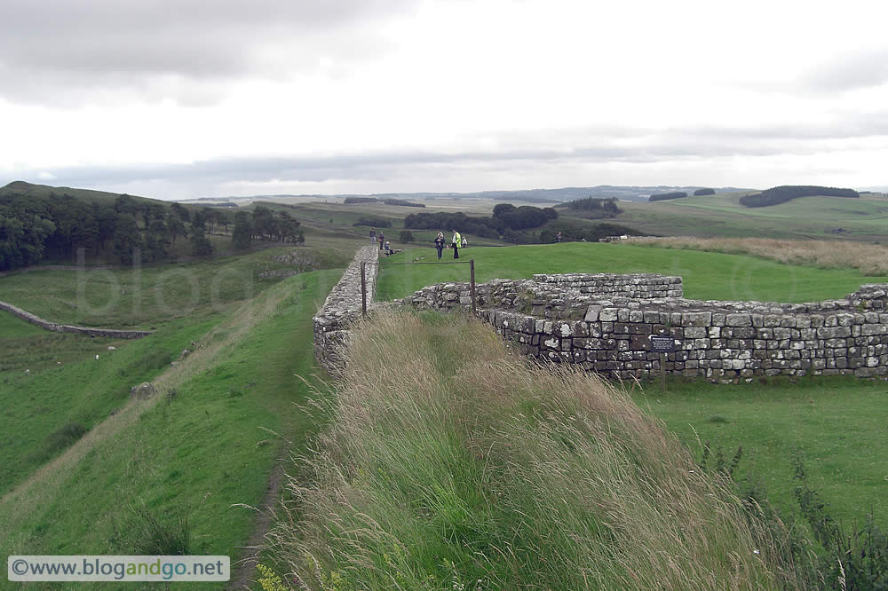
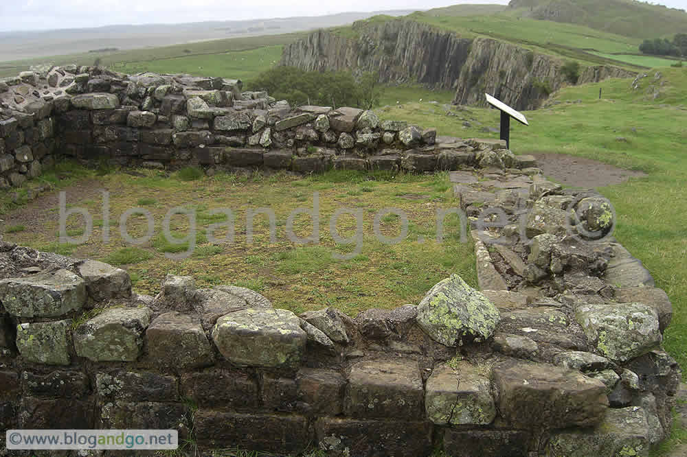
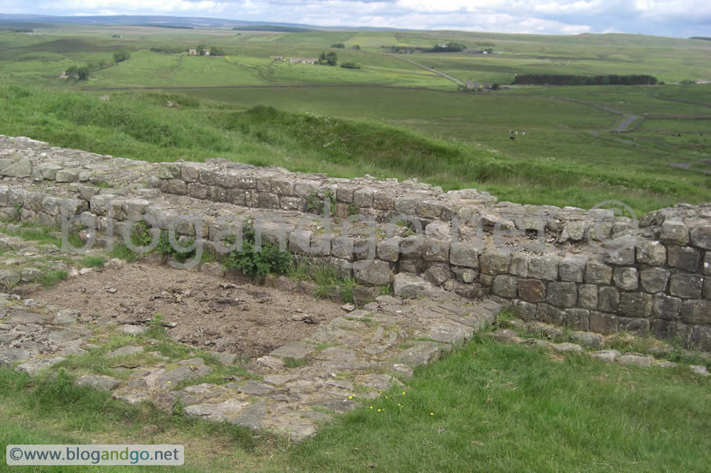
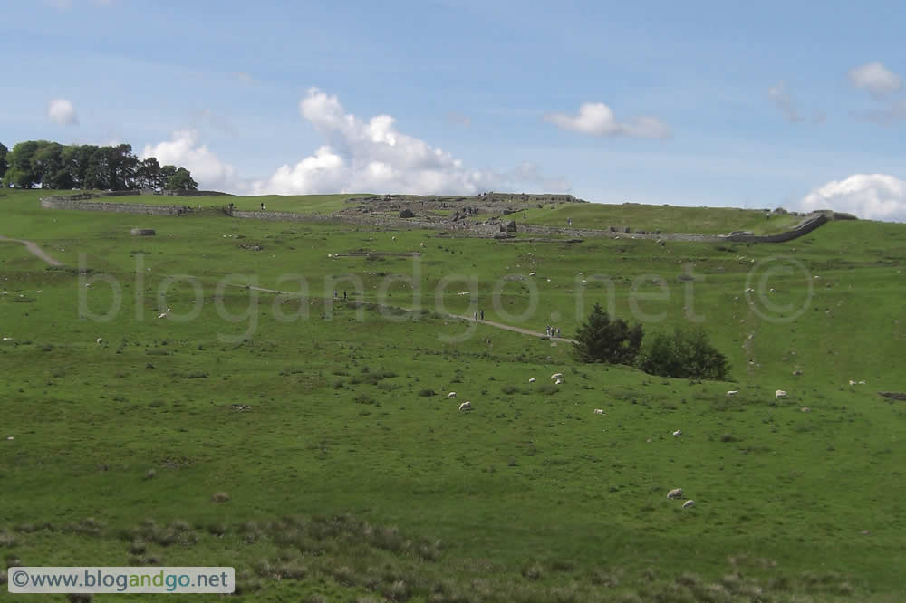
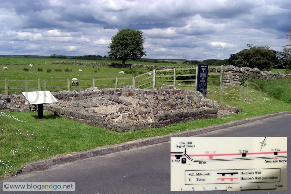
The day started with a bus back to the village of Once Brewed and a short walk back up towards Steel Rigg before turning right onto the Hadrian's Wall path. This was all new ground as Once Brewed represented my end point at the last attempt in 2008. The climb will eventually level out and bring you to Housesteads fort (which I got to by bus from Vindolanda last year). If you were a Roman auxiliary soldier based here I get the feeling that this would have been a comfortable section to be assigned to; located in an almost impregnable fort with the comforts that come with being in a large base, patrols on a wall sitting on top of practically unscalable cliffs, and being backed by a formidable military machine, life must have been relatively comfortable.
With fine views all around, positioned on high, steep ground, and obviously more than just a milecastle or turret, this would have been a tremendous statement to those beyond the Wall. Even approaching from the south which I did last year, it was clear that it would have impressed those on the Roman side of the Wall as much as those on the other side.
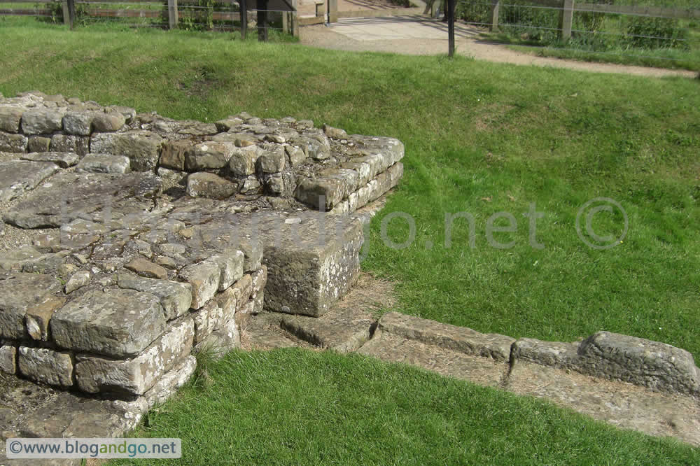
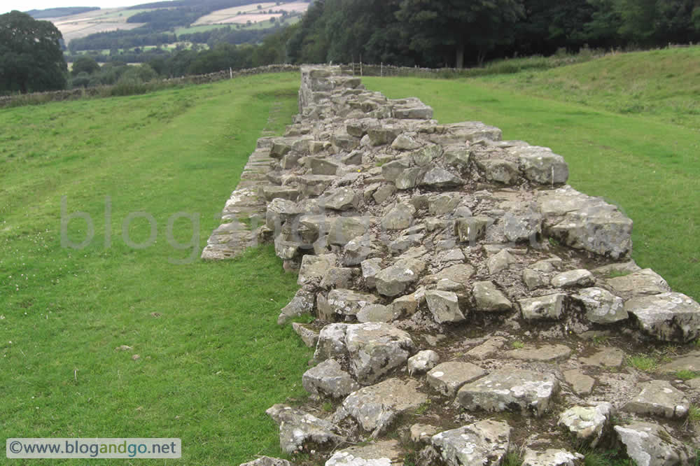
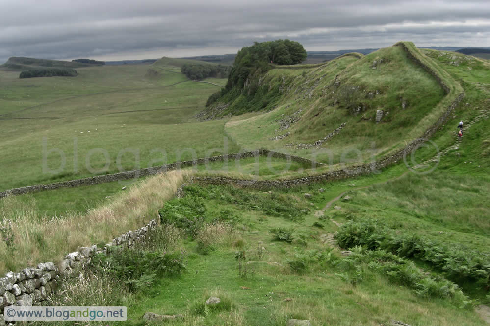
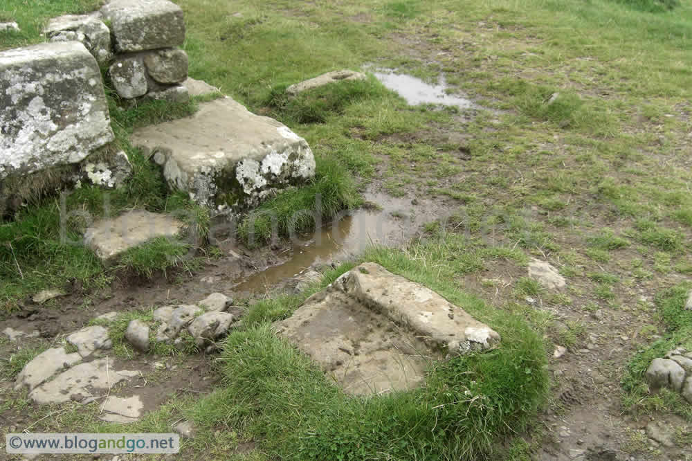
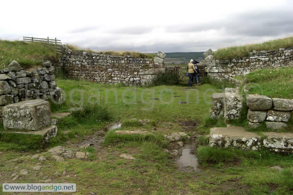
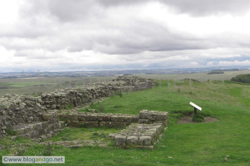
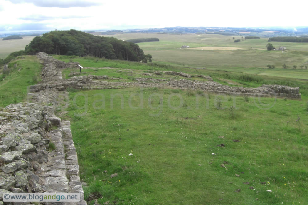
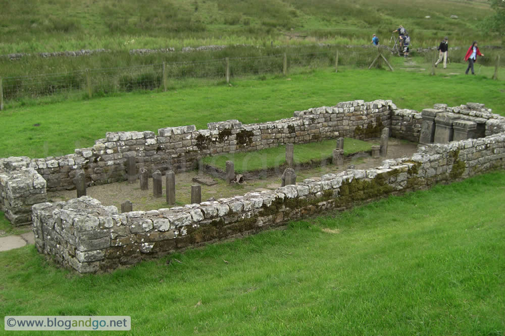
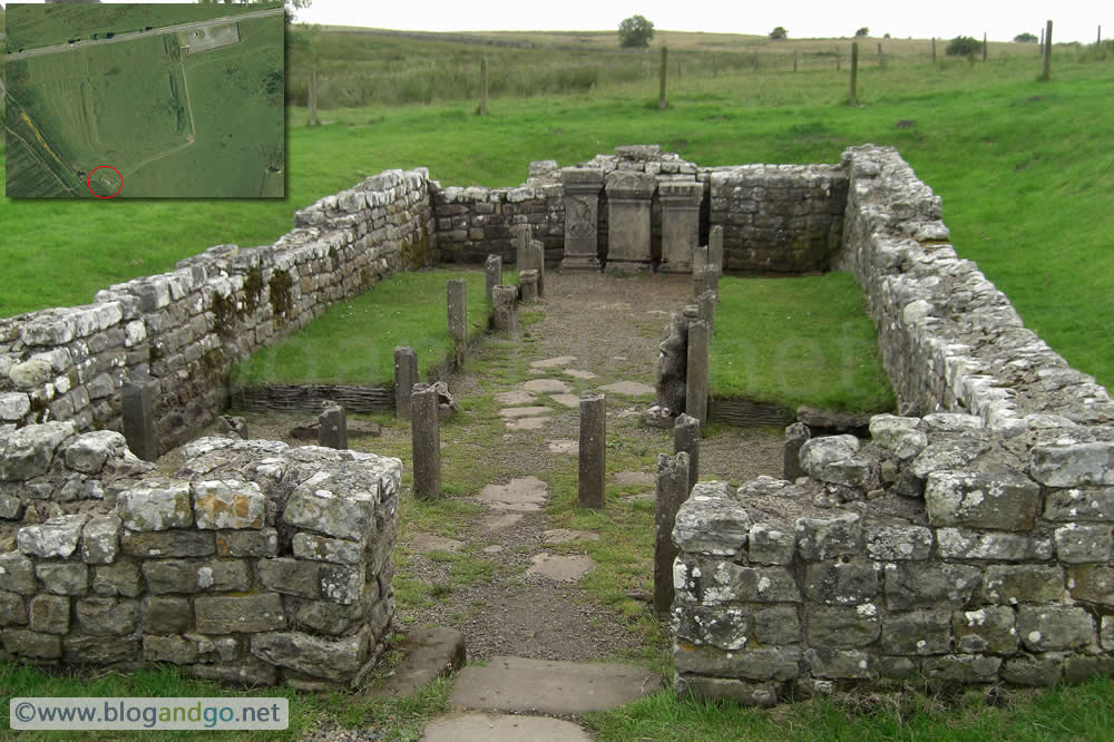
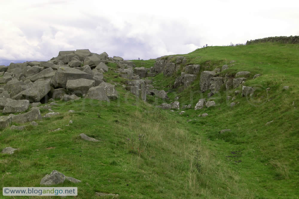
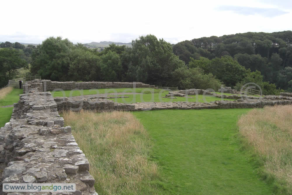
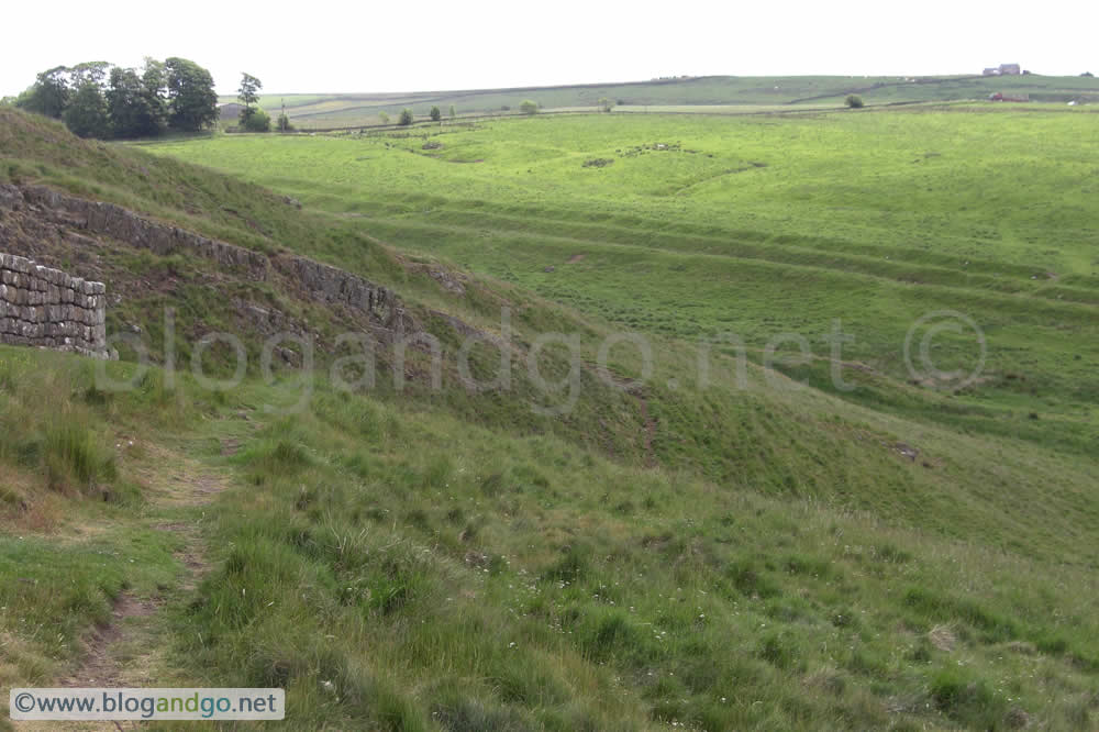
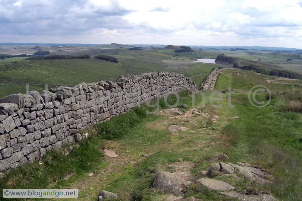
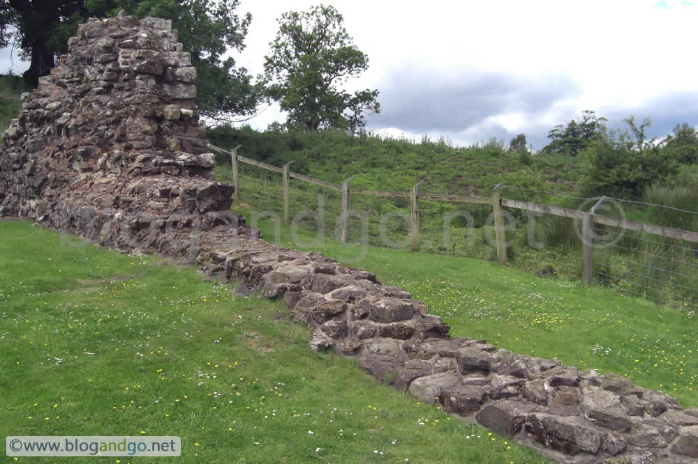
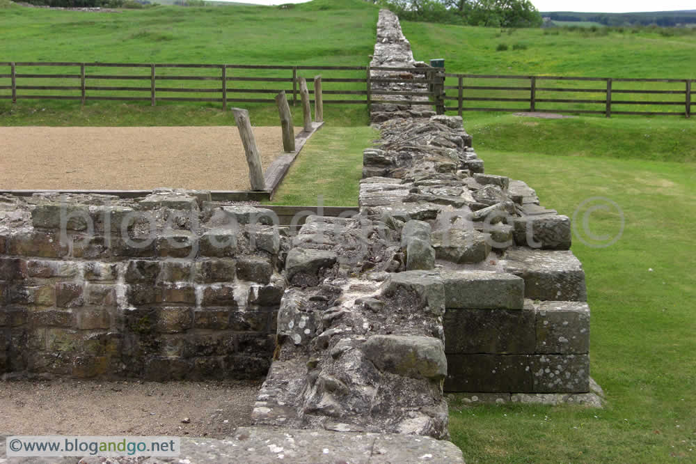
The path to Chesters brings you along fine examples of the Wall, plenty of turret remains, milecastles, forts and a temple. The ditch is in evidence for much of the way, and the section at Limestone corner is gives an indication of the intensive labour involved in obtaining the rock to build the Wall as well as to create the ditches.
.jpg?open)
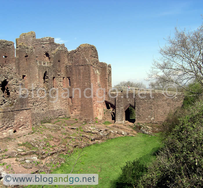
Completing Hadrian's Wall walk (3 of 6)
Hadrian's Wall Walk - Birdoswald to Steel Rigg
Rather than carry our full kit mile after mile each day, we decided to set up base at a campsite in Greenhead and from here drive to the starting point of our walk for the day and then get the bus back to the car at the end. At least this meant our load was lighter and we had the luxury of a hot shower each night though the downside was that we had to stick to a bus timetable.
Last year I missed the (obvious) turning to Thirlwall Castle and ended up in Greenhead, following the road to Cawfields and a night in Haltwhistle. Without repeating the mistake, part of today would bring new sights!
Day 3 - Birdoswald to Steel Rigg (10 miles)
Getting the bus to Birdoswald to restart from the point we finished yesterday, and with only a day sack, the walk was a much more enjoyable tramp compared to last year. By staying on the route, Thirlwall Castle, the impressive section of wall at Walltown, and the site of Aesica fort were the new sites missed from last year. After Aesica the path takes you to Cawfields which is where I got to last year with ruined feet and in search of accommodation.
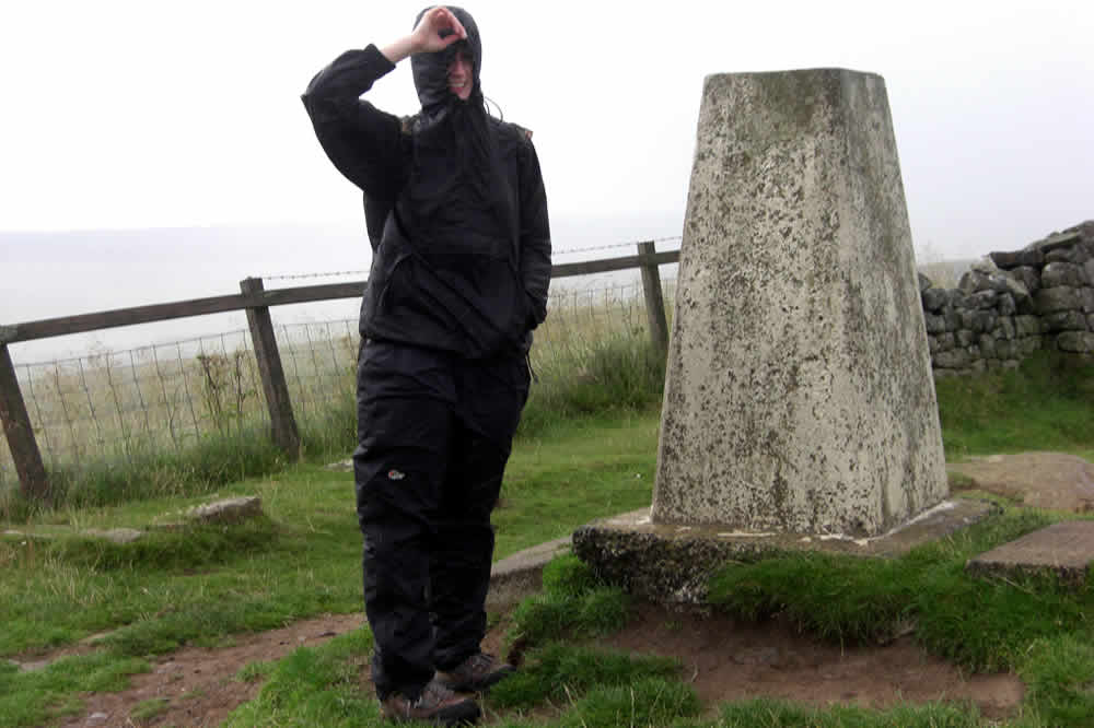
From here we followed the path along the Cawfields and Winshields Crags to trig point 345. Drizzle and heavier rain were our constant companion which is bad for photography especially on this, the iconic and most scenic parts of Hadrian's Wall.
We descended from Winshields and turned off for Steel Rigg, the village Once Brewed on the B6318, and a bus back to our tent in Greenhead and a well deserved pub dinner.
 fort.jpg?open)
Completing Hadrian's Wall walk (2 of 6)
Hadrian's Wall Walk - Grinsdale to Birdoswald
After the torrential rain of the previous day which made finding a suitable campsite difficult because the ground was so saturated, we were mercifully treated to a clear and dry night. We woke early and set off at 07:00 for a long day of walking through the spectacular and changing landscape of northern England. Most of the walk takes you through countryside with only a few remains of the wall to be seen.
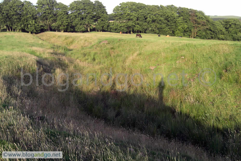
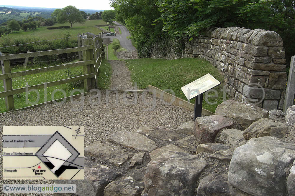
However, the observant will see the ditches and ridges that betray the fact you are walking the route of the wall. It is not until you get to Hare Hill though that what was once walk in the country turns to a walk along an ancient monument which formed the boundary of a great empire. This is the first part of the wall if you started your journey in Bowness-On-Solway.
Day 2 - Grinsdale to Birdoswald (21 miles)
Good progress probably because the day before was a relatively short walk. After reaching Birdoswald and exploring the site, we got a bus to take us to Greenhead and a campsite. Luxury! Hot showers and a base for the next few days.
Completing Hadrian's Wall walk (1 of 6)
Hadrian's Wall Walk Bowness-on-Solway to Grinsdale
Last year I attempted the 84 mile long Hadrian's Wall trail carrying an initial 27kg of kit but had to admit defeat after 45 miles because of ill fitting boots leading to severe blisters. This year I was determined to complete the trail not just for a sense of personnel achievement but also to pursue my interest in Roman history and to see what I had missed out on the preceding year. Though a lot of the stone used to build the wall and other structures has been carted off by later generations for use in their own building projects, there is still plenty of evidence to allow one to marvel at what must have been an astonishing structure and symbol of Roman power.
Like the year before, I set off from Bowness-on-Solway, but instead of starting in the early morning, I didn't begin until 15:30. I took a wrong turn last year, at about 35 miles in, missed Thirlwall Castle, and continued off the trail for about 6 miles thus missing some of the most dramatic scenery to be seen on the wall. This year I did not make the same mistake and faithfully followed the wall as far as possible.
A change in tactics resulted in the big heavy rucksack being carried only for certain stages of the walk and left behind at a campsite for many of the stages.
Photos for this trip will mainly cover the sections that I missed last year.
Day 1 - Bowness-on-Solway to Grinsdale (10 miles)
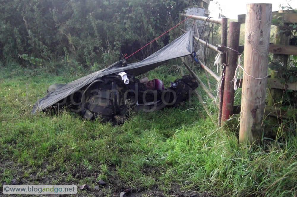
The familiarity from retracing the footsteps of the year before made progress quite straight forward but the major change compared to previously was the weather. While last year saw fine and sunny weather predominate, this time showers and torrential rain that turned roads into rivers was an added challenge. We spent some time sheltering and drying off, which added to our late departure saw us only cover about 10 miles in our first day. As the day turned into evening we began to approach Grinsdale, a small village outside of Carlisle, and found a location to stay for the night.
Due to the heavy rain, the field that we were in was quite boggy, and whilst far from ideal, was a good enough location to get some food on the go and have a good night of rest.
Walking Hadrian's Wall (3 of 3)
Hadrian's Wall Walk - Cawfields to Housteads (via Vindolanda)
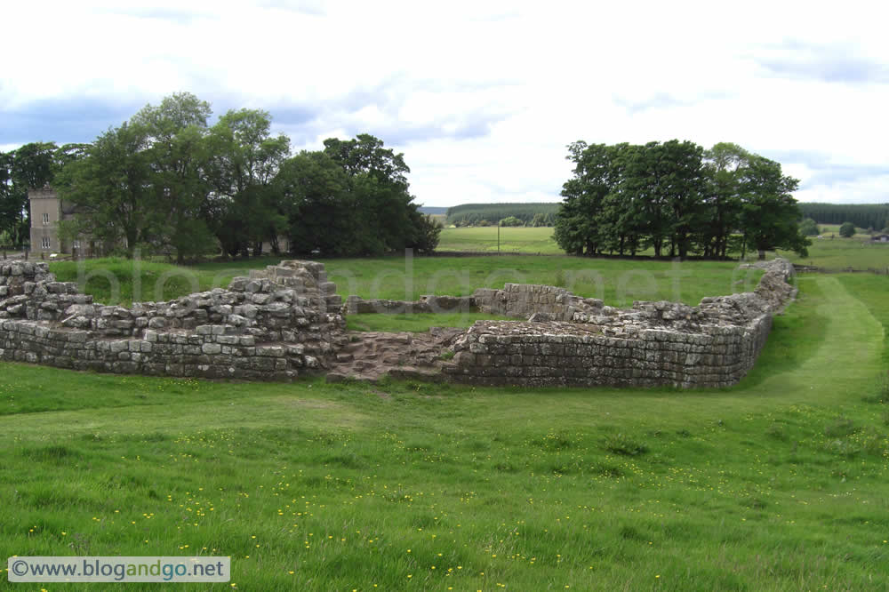
The bed and breakfast owner saved me the walk back to the wall and drove me to Cawfields, allowing me to continue where I left the Wall the night before. This section of Hadrian's Wall offers some of the best preserved and typical examples of the Roman remains to be seen along its entire length. Starting with Cawfields Milecastle, evidence of gateways that would have allowed trade between the North and Roman Britain can be seen.
Climbing east, past two milecastles, the wall reaches its highest point at Winshields Crags, giving great views of Northumberland National Park.
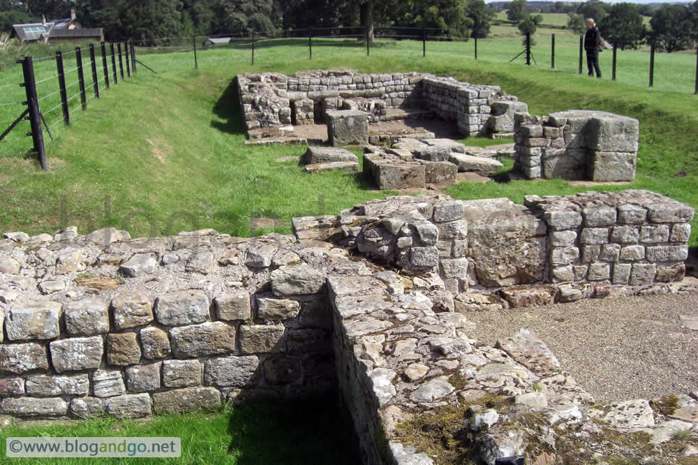
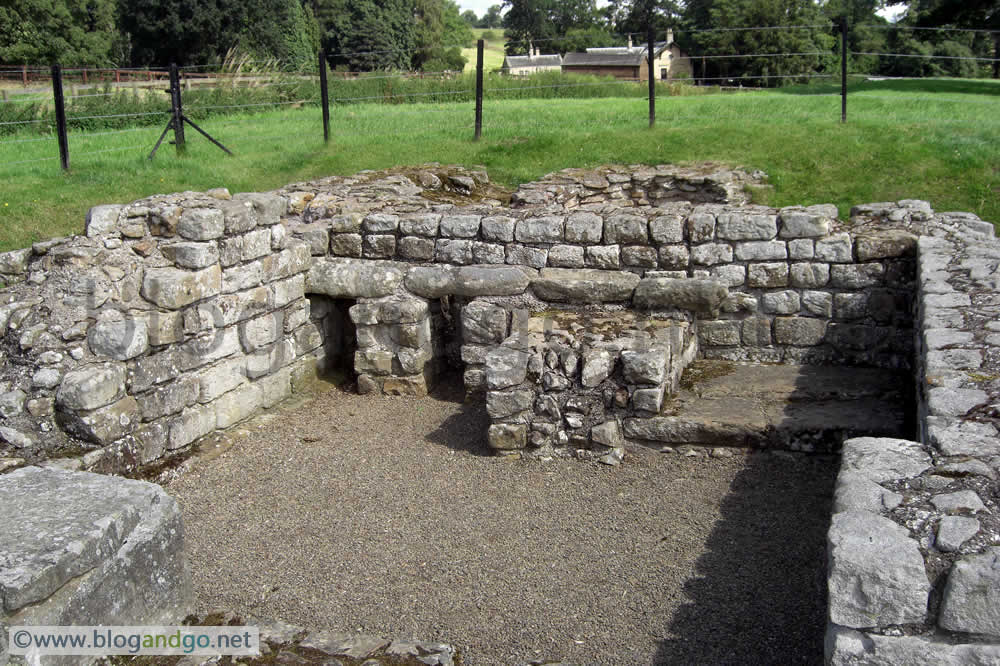
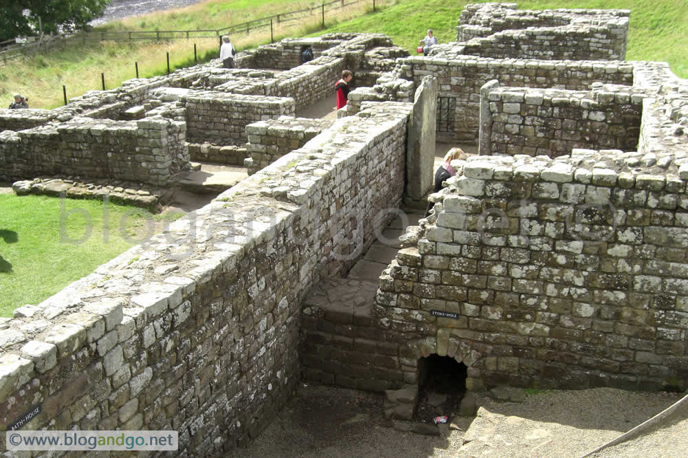
Some of the most interesting monuments are in this section such as Vindolanda Fort, one of the most famous and excavated Roman sites in Britain. After walking to and exploring it, I made my way by bus to Housesteads Fort thus missing out about a mile of Wall and the scenic Crag Lough but by now my feet could take no more.
From the bus stop up to Housesteads fort is a 1km, steep slope which was further hell. After a look around it was back down the hill for the AD122 bus back to Carlisle and then from there to Bowness on Solway.
Hadrian's Wall Path - Day 3 (7miles)
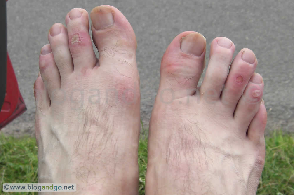
Mileage: Approximately 4 miles from Cawfields to Vindolanda, and maybe a mile walking up to Housesteads including distance travelled wandering around the sites. In all, about 44 miles - not bad considering the time taken to look around the sites dotted along the way with a backpack averaging 25kg. Despite this, it was disappointing not to have completed the wall because of the wrong boots.


.jpg?open)
.jpg?open)
.jpg?open)
Walking Hadrian's Wall (2 of 3)
Hadrian's Wall Path - Bleatarn / Newtown to Cawfields
After a breakfast of pasta and pesto we set off into an early morning rain shower soon which soon gave way to clear sunny weather. Not long after, Adam turned off the path and toward Brampton at about 11:00 as he was only able to join me for the weekend.
In remote countryside, the scenery varied from fields, country lanes, woods then the rolling hills leading up to the first visible sections of the wall. At this point the wall is only reconstructed as a marker, one rock thick but what gives it away that this is actually the site of Hadrian's Wall is the ditch which is still visible.
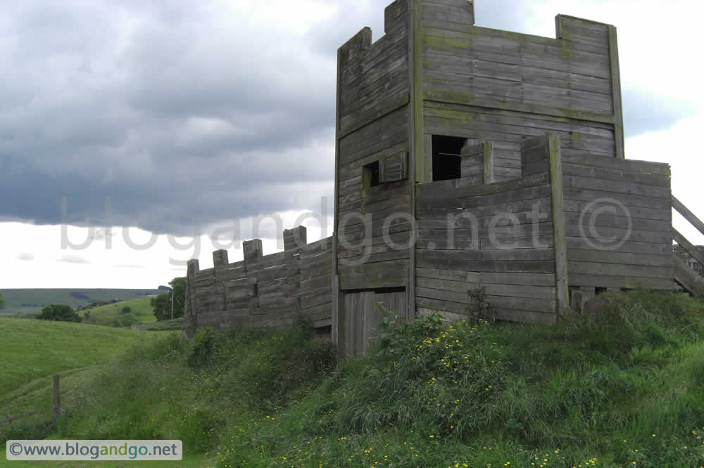
The Wall was part of a military zone and the first line of defence was this 3m deep and 9m wide ditch, dug several meters in front. After walking for several miles next to this, the enormity of this whole construction and feat of engineering hits home. Back in AD122 this would have been a supreme exhibition to the local tribes of Roman power and know-how.
The first true section of the wall can be see at Hare Hill and at this point I felt that the hours of trek had finally got me to where I actually wanted to be. As much as I enjoyed the countryside, what I wanted to see was the wall and the other monuments that represented life at the limits of the Roman Empire.
Many hours and monuments later, and with raw feet, I began the search for somewhere to pitch up for the night. By about 20:30 I found some woods just off the trail that looked ideal. Bad choice. I was quickly swarmed by midges and even when I got into my gortex bag leaving a small gap to allow air in, the midges still swarmed about and found their way in. After 10 minutes of this I decided to make a run for it, packed up and escaped the woods! I walked on hoping to find a bed and breakfast.
One worrying aspect of the day was that as I was walking alongside a road, making sure that I walked into the direction of oncoming traffic rather than it coming up behind me, a driver actually started aiming his car towards me and I had to take evasive action to be sure that I would comfortably avoid the lunatic.
By 21:45 there was no room at the Milecastle Inn which by now was a hard, unplanned, half mile walk away from the wall to the B6318 which runs roughly parallel to the path. However one of the staff had come to the end of her shift and offered me a lift into nearby Haltwhistle where luckily I found accommodation. In retrospect, I could have found a windy place on the wall as that would have been midge free. Still, sichuan chicken and rice was a better alternative to yet more pasta. Neither was I going to complain about a shower and hearty breakfast either.
Hadrian's Wall Path - Day 2 (17 miles)
So, today's mileage was: about 3 miles from Blearton / Newtown to Walton and 14 miles from Walton to beyond Cawfields Quarry (near the Milecastle Inn, where I got a lift into Haltwhistle and including wandering around sites) - 17 miles. Strangely enough, my shoulders had adapted very quickly and did not hurt anywhere near as much as yesterday. And so far, all I have seen is people carrying either a light day sack or nothing more than a stick. Unlike my now 25kg!


.png?open)


Walking Hadrian's Wall (1 of 3)
Hadrian's Wall Walk - Bowness-On-Solway to Bleartarn / Newtown
It was my intention to do the whole walk in 4 days even though the guidebooks recommend about 6 or 7, allowing time to see the many monuments along the way. With Adam, my chum from University and fellow adventurer in Patagonia in 2001, we met in Carlisle, and drove to Bowness-On-Solway which is the starting point if you intend to travel from West to East.
As we met late in the evening on the 13th, we spent the night at the local pub downing a few beers and mixing with the friendly locals. One of the merry locals known as 'Ernie' was willing to allow people to put their tent up in his back garden in exchange for a couple of pints and so it was from Ernie's garden that we started the hike.
I was equipped with kit weighing 27kg, of which 2kg of was pasta, 4.5kg (4.5 litres) water as I was unsure about replenishment spots along the way, a poncho and sleeping kit (a gortex bivvi bag and sleeping bag to go inside) plus the usual things e.g. spare clothes, gas cooker etc). This is a fair weight but I wanted to be self sufficient for the full 4 days of hiking. This may have been okay if it wasn't for my footwear. Most people find a base to leave their things and just take a day sack for each stage.
Hadrian's Wall Path - Day 1 (22 miles)
We left Earnie's garden at about 08:00, found the path and walked a short way before locating a scenic spot to settle down for a breakfast which was pasta and pesto. Hadrian's Wall Path is a well marked out route and is a Long Distance National Trail. At the time of writing there are 15 of these trails, many of them far longer than this.
The walking is easy, though can be muddy in places but at this relatively dry time of the year the path was baked hard. The highest point on the path is only 345m, and for most of its length is more or less flat. Though most of the Wall is in remote countryside, lengthy sections pass through the cities of Newcastle and Carlisle.
The first 14 miles or so took us through countryside into Carlisle. At this point my feet were suffering and I realised that I had made a mistake with my boots. These were about a half size too small and they didn't have an insole either! Luckily, being back in Carlisle I was able to buy some insoles but unfortunately there was nothing that I could do about the too-small boot - at least without spending a considerable amount of money. By now it was about 16:00 and we tucked into a MacDonalds before heading back out onto the trail which took us through the North of the city and across the River Eden.
Upon leaving Carlisle behind we again hit the country trails and village roads, passed Crosby and ended up in a dip out of sight in a field between Bleatarn and Newtown. This was a good time to stop because at this point our rest breaks were coming more regular and our pace was slowing. My shoulders were aching from carrying my bergen but this pain had kicked in hours before. We made 'home', had scoff and were asleep by 22:00.
All in all, this was a good first day despite the slackened pace at the end and the pain contributed by my inappropriate footwear.
Distance covered: Roughly 15 miles from Bowness On Solway to Carlisle and about 7 miles further on from Carlisle to Bleatarn / Newtown.